We discovered early this morning that there was another ship in the Bay. And that’s a first on this voyage - everyone else is way over east visiting the Antarctic Peninsula, lucky us! Our Expedition Leader was keen to make a landing on the beach to see Borchgrevink’s hut so we were called to an early breakfast in order to maximise the time we could spend in Robertson Bay before heading north to Macquarie Island.
Samuel got two boatloads landed through the surf but then called it off as it was proving just too dangerous. One zodiac got swamped and waves were breaking over people - no wonder they pulled up stumps and retreated to the ship. But they took all the zodiacs out to cruise around the beach later.
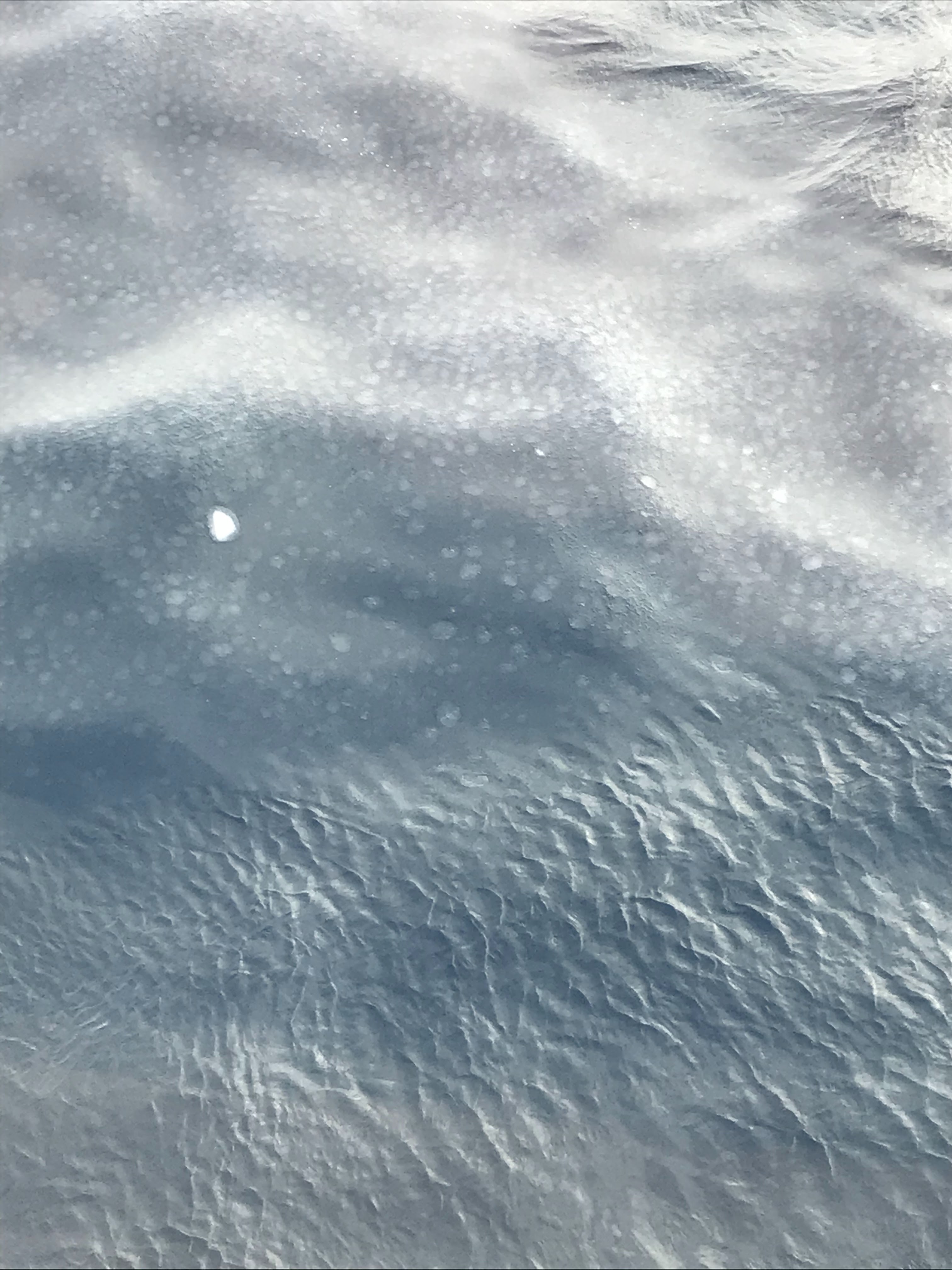
It looks fairly innocuous, but it was treacherous between the icebergs and shore
The long-awaited Polar Plunge took place before lunch that day and 11 stalwarts leapt in. In spite of my intentions, I decided against it - I had a cold and the weather was icy. And Lindsay. in view of his recent surgery, was advised against it by the ship’s doctor. And we were being stalked by a Leopard Seal - they have been known to attack humans particularly if they are wearing black!!! That would have been me - a good decision for me!
That's Samuel in the zodiac ready to help if needed. Note the ice in the water! very cold
That splash was Al, one of our chefs, who jumped off from deck 4. Brave crazy boy!
After lunch, we spent the rest of the day taking pix as we sailed NNW towards the Balleny Islands on our way to Macquarie Island.
We revisited the desolate Inexpressible Island on our return journey back north. The weather was a little kinder than four days earlier so a group of people went ashore. The sea was still a bit too rough for me so I, and many others, decided against it, but I wished I had joined them as this island has some of the best examples of lichens in this entire region and also some amazing rocks as well as the odd penguin. I say ‘odd’ because the landing party came across an Emperor penguin on land and that’s most unusual. These penguins rarely go ashore living their entire life on sea ice, ice shelf or at sea.
It was getting colder by the day!
It was an icy cold -5C morning as we slowly sailed out of the Ross Sea towards Cape Adare and Robertson Bay for another attempt at landing on the beach near Borchgrevink’s hut. As we retraced our steps northward, we encountered much more ice and snow than we had seen just 7 days earlier - winter was fast closing in.
Possession Island - a quite magnificent and stark scene
Last year's sea ice starting to clump
We sailed past massive icebergs adrift in a fast-freezing sea
When we reached Robertson’s Bay, we found that it was too rough along the shore to land, so we sailed further on to the head of the bay. Quite spectacular with an island, Duke of York Island, almost free of snow and ice, backed up against a couple of converging glaciers.
Cape Adare looked so different from when we arrived a mere 7 days earlier.
Duke of York Island, the dark mass on the right.
We anchored in the Bay overnight so we could try to go ashore to inspect the hut in the morning.
Cape Crozier is on the east and is almost engulfed by the Ross Ice Shelf
Indeed, it feels like the last frontier! This morning, I woke with a sore throat, the result of spending too long out on the frozen deck last night at a chilly -12C, so I stayed rugged-up in our cabin for the morning. In the meantime, the ship ploughed on around Ross Island to Cape Crozier, the most easterly point of Ross Island, and then along the edge of the Ross Ice Self. Fortunately, we had a front cabin so I could watch out two windows – front and side. The captain sailed the ship so close, you felt you could almost reach out and touched the ice. It was a vast flat expanse of dazzling sparkling white, quite beautiful but terrifying in its unyielding front.
The edge of the Ross Ice Shelf from the front window of our cabin
You can see where chunks of the ice shelf have calved off
The vastness of the continent has been sneaking up on me gradually as we have sailed down the western part of the Ross Sea as far as Ross Island and the ice shelf. Back in 1841, Sir James Clark Ross sailed along this huge wall of ice that we now know as the edge of the Ross Ice Shelf. That shelf was formed by the convergence of numerous glaciers flowing seaward from the high ice plateau. Its age is unknown but supposedly the ice cap of East Antarctica reached its current expanse 6 million years ago and still continues to grow. The ice from that frozen plateau gives birth to great glaciers which push immense ice tongues many kilometres into the sea - the Drygalski Ice Tongue which we sailed past extends 80 km into the Ross Sea. On the western aspect of East Antarctica, these giant glaciers ‘squeeze’ between gaps in the high Transantarctic Mountain Range that divides the continent into two distinct geological regions, East and West. Geologically, West or Lesser Antarctica closely resembles the Andes Mountain range of South America. East or Greater Antarctica predates it, with some rocks dating back more than 3 billion years - part of the earth’s old crust.
But back to the Ross Sea .... It doesn’t look that big on a map but it is almost 1000 km across and covers an area of 960,000 square km. It’s coastline measures over 4,000 km. It is home to ~40% of world’s Adelie Penguins, a quarter of all Emperor Penguins, 50% of the world’s Weddell Seals and, among other species, it is home to over 2000 invertebrate species. The Ross Ice Shelf, home to one of the largest populations of Emperor Penguins (20,000 pairs), has an area of over 500,000 sq km, twice the size of Victoria (about the size of France). It’s expansive and quite thick – towards the edge it is perhaps 300-500m thick but further south it is much thicker.
It is a phenomenal place, a wonderful sight, but the temperature was dropping so we turned for north and more wonders.
That same day, after visiting Discovery Hut, we sailed further south in McMurdo Sound to Scott Base, NZ's base. It was quite picturesque as it was snowing gentle flakes. A number of people went ashore to inspect the old huts. We then spent the rest of the afternoon and evening sailing close to the McMurdo Ice Shelf looking for wildlife. We saw Adelie and Emperor Penguins and Weddell and Crab-eater Seals and a few Minke Whales plus other beautiful creatures. It was glorious.
The green structures are part of the NZ Antarctic base - Scott's Base.
We were intrigued to discover that there's a huge runway along the McMurdo Ice Shelf.
Sir Edmund Hillary was based at Scott's base in the mid-1950s when he led the New Zealand component of the Commonwealth Trans-Antarctic Expedition. He was the first person to arrive at the South Pole by vehicle.
The sea was slowly starting to freeze, forming tiny disks which coalesced to form pancakes. This was no problem for our little ship but there was still some of last year’s ice which was much thicker - we munched through it. Aleksandr, our captain was having a wonderful time and didn’t stop smiling the entire time. He nudged the ship right up the ice shelf, so close we felt that we could reach out and touch a pair of Emperor Penguins preening on the edge of the ice.
Everyone, crew included, were hanging over the ship side as we touched the ice shelf
In spite of the freezing cold, the evening was glorious, so we stayed around that patch of sea for hours, photographing and videoing.
It was exciting crunching through the growing ice sheets
Emperor Pengions on the left, Leopard Seal on the right
We cut a crazy path through the ice as we tracked these glorious creatures
The Emperor Penguins were wonderful and the Captain, careful not to spook them, took the ship in wide slow circles in order to get us a little closer. And while we were watching them, a sleek Leopard Seal was watching us. We were all reluctant to leave that glorious place, so we dined pretty late again that night. Having spending hours out on deck in this little patch of heaven under pearly skies, it was not surprising that next morning I woke with a bit of a cold. But oh! what a splendid evening it had been alone in the silence of ice and sea and pearly skies.
Over a few days we visited the places on Ross Island where the expedition huts built over 100 years ago by Scott and Shackleton’s early expedition teams still stood. Amazing! We were fortunate to be able to land. A month ago, this same ship couldn’t get to some of the spots because of high seas and winds. Lucky us! All the while, Mt Erebus loomed nearby, quietly puffing out ‘steam’. The scenery was always spectacular!
There were wind turbines on the Hill to replace the former nuclear power station
There was little wind and the temperature was a balmy -4C as we dropped anchor that morning to visit Discovery Hut. This hut had been built on Scott’s first expedition in 1902. We landed close to the huge US base, McMurdo Station, which houses over 1000 personnel, some all year round. We weren’t invited in, but we did chat to a few guys out for a walk.
It was another icy landing at Hut Point Peninsula
Before entering the hut, our boots had to be brushed clean
A pile of seal blubber and bones used to make soup etc - yummy!
100-odd year old expedition biscuits. Hard as wood but sufficient for a meal with a hunk of cheese.
It was a long wait to get into the hut as only a few were allowed to enter at a time, but it was worth it to experience the living quarters these stalwart explorers braved. It was tough living and even tougher on their attempts to reach the Pole. At times, the men in the expedition parties survived on just one of those hard biscuits per day. They were quite large and with a chunk of cheese they would make a meal - or so the story goes according to David, our historian. Imagine hauling a sledge all day with little left to eat,
A colony of Adele Penguins
Communications station perched high on a ridge behind the US McMurdo Station.
After we had solemnly tiptoed through the hut, we climbed a snowy ridge behind the hut and came across a colony of Adelie Penguins. They are the cutest things, all huddled together chattering constantly. We walked up the ridge to a memorial. It was a bit precarioua as the drop one side was steep and treacherous straight onto the rocky shore. It was very stark but so beautiful: a chilly black and white scene dotted here and there with the bright flashes of coloured jackets of our fellow explorers.
A memorial to George T Vince, a member of the British Antarctic Expedition 1901-04 who lost his life near here.
Satellite image of Ross Island (L) showing the two hut locations we visited.
Having passed Cape Royds on Ross Island with a promise to return, we headed to Cape Evans where an expedition hut from the early 1900s still stands. This is the site from which Scott and a small party of his expedition team set out for the South Pole, tragically never to return. It was a dark and bleak promontory. Towering behind those two capes, is the infamous Mt Erebus. It was to loom quietly in the background for a number of days. Awesome.
We loaded into zodiacs and headed for the shore where we disgorged onto an ice-encrusted black sand beach at Cape Evans. We were there to visit Scott's hut.
A beach landing on ice-encrusted black sand beach .
Weird and fanciful mushroom-like formations carved by wind and water lined the beach
Scott's hut in the distance
Lean-to stables adjoined the hut. Against them is propped one of the original wooden sledges
The hut had stables where the poor expedition ponies were housed. How Scott ever thought that ponies could survive in the bitter conditions of the Antarctic I can’t imagine. Animals were brought along on these expeditions as transport and food! What madness. The ponies died of course. The shell of the hut has been rebuilt but what remained inside is as it was left, including the meteorology station built 100-odd years ago on the hill behind the hut. We felt like intruders picking our way through the remnants inside and out of the Cape Evans hut. I found myself almost in a whisper as we wandered around the hut and surrounds. Behind the hut and stretching up the hill was the detritus of those early expeditions.
Of course we lined up for the obligatory photo.
Before creeping into the dark interior of this ill-fated hut, we got a couple of snaps taken for posterity. Then, after cleaning our boots, we ducked our heads and entered this astonishing museum, a perfect tribute to the brave explorers of yesteryear. It was just as they had left it.
Fascinating to read the labels on the boxes of stores. We even found a chest of sea-biscuits
Top R strips of seal blubber, Bottom R a sleeping bags made from reindeer hide, Bottom L Scott's 'office' complete with penguin ready for dissection.
It was an Aladdin's cave that swept you back to a bitter difficult time. Here, and at other huts, there were piles of blubber dating from the early 1900s completely preserved in the intense dry cold. They used the blubber for various things including cooking and light. It had been a fascinating morning which held us engaged for hours - that meant a late lunch.
Shackleton's hut - a pale structure centre image. To right of the hut was the protected penguin colony.
It was a glorious albeit icy scene with a ghostly Mt Erebus in the background.
Later that day, we returned to Cape Royds in order to visit Shackleton’s hut. A landing was possible, but it promised to be rather rough, followed by an even rougher climb over a rocky ridge to reach the hut. Access to the hut was limited because it was adjacent to a protected penguin colony. So to reach it people had a long clamber over the rocky hill to the left of the hut. Although I was very interested in Shackleton, I didn’t go ashore because the climb to the hut looked a bit too dangerous for me. As it turns out, it was very precarious. A number of passengers sustained minor injuries, and one poor guy fell down the rocky hill amongst the rocks and had to be rescued by our wonderful Russian sailors. Lindsay came back to the ship rather shattered after having raced ahead of the group to get help and in the process, strained his already compromised rib muscles - and that’s another story. From all reports, it was a pretty rough trek to the hut, so I was glad I hadn't gone! By the time everyone was back on board, it was after 9pm so we ended up having a late dinner that night. Such is the nature of these kinds of expeditions - weather, sea and terrain determine the pace.
As we travelled further south, the temperature gradually dropped lower and lower until we woke to ice on the inside of our cabin window, icicles hanging from the storm-door frames and snowdrifts collecting out on deck. Quite exciting! but the landscape was rather windswept and desolate. The whole scene was, indeed, almost inexpressible. One can only imagine what was in the minds of the wretched explorers when they arrived at and named this island 100-odd years ago - Inexpressible Island. It's a lonely and hostile place, so not all the waters are charted around here. The days we were there, the wind was blowing hard, reaching 80-90 Kph and the temperature was -12C. Yet it was sunny with blue skies.
We had to scratch a hole in the glass on the Bridge to see out. Thrilling!
Everyone was up on the Bridge to see this desolate island where Scott’s north party who, having missed the ship because of advancing sea ice, were marooned and had to spend 'winter' in 1912 in an ice cave they had dug in a huge snow drift.
Approaching Inexpressible Island we had a porridge sky
In the stretch of snow behind Harrowfield Hill, Scott’s north party dug in to spent the 1912 Antarctic winter.
We were fortunate to have Dr David Harrowfield, Antarctic historian and lecturer, on board with us. For many decades, David has worked in the Antarctic and has also been associated with the preservation of much of the remaining artifacts from the Heroic Age of Exploration - we were to visit some of those sites as part of this expedition. He was dubbed Antarctica's first archaeologist in 1977 and has the honour of having an Antarctic landmark named after him, Harrowfield Hill, in recognition of his work as a geographer and historian over four decades. The 95m hill is close to where six members of Scott’s ill-fated Terra Nova Expedition survived for 209 days in a snow cave in 1912, when their ship was unable to get through the sea ice to pick them up. It was eerie approaching this island, listening to him describe how the explorers managed to survive here. It really is a desolate place. On the following video, you will hear how vicious the wind was - it was hard holding my iPhone steady.
Hell's Gate
Behind the island is the Priestly Glacier with its terminal moraine, probably very appropriately named ‘Hell’s Gate’, that spreads out below the 2700m Prince Albert Range. Behind that mountain range the polar ice cap can be seen stretching inland. A wild, fearsome, unchartered and exciting place to encounter. It was so very different from the Hell's Gate we saaw in Darvaza, Turkmenistan - or the bespoke five in Australia.
We spent the rest of the afternoon watching the sea getting whipped up and away, creating shimmering rainbows. A beautiful overlay to the wild sea which was showing signs of beginning to freeze.
The sea has many phases as it freezes: this surface stippling is part of it. Quite fascinating.
We were to visit Inexpressib;e Island again on our return journey north four days later.
At the end of every day we looked forward to a few warming drinks and a good meal.
The Ross Sea (click on the image for an enlargement)
We had arrived in the Ross Sea (I'll tell you a little more about this huge sea later). We woke to ice on the inside of our cabin window and the temperature didn't climb above -6C all day.
The ice is on the inside as well as on the outside. We had arrived at Antarctica!
Around dinner time after a chilly day at sea riding choppy waves whipped up by 50 kph wind, we arrived at Terra Nova Bay where a few research bases are located - Italian, German, Korean. The mood on board was one of great excitement and, yes, a tiny bit of apprehension as we struggled into layers of warm clothes and waterproof gear ready to take our first steps on this most mysterious of all continents - Antarctica. On top of our clothes went a thick hooded jacket and life vest - and finally a backpack! Then, looking like astronauts clumping along in our huge gumboots, we very carefully picked our way down the gangway to 'step' into the waiting zodiacs bouncing crazily on a way too-choppy sea - I actually collapsed gracelessly, rather than stepped into the zodiac - my excuse is that I tripped over my way-too-big boots! There were always 2 ship's crew to help you into and out of the zodiacs shipside. They were wonderful, reassuring and strong seamen and most of them, the crew, got to go ashore at one landing or another. Our Captain was no exception. He took his turn helping us. It was his first time captaining a ship in the Ross Sea and he was so excited. Wonderful man who seemed to be in the Bridge day and night. The zodiacs pulled in to shore on breaking waves and we were disgorged onto a small slippery platform of ice - pretty unnerving having to quickly step onto the ice at the right cycle of the wave (with no crampons)!
Michelin Man Lindsay
This is the gorgeous Captain of our ship taking his turn at driving a zodiac - and going ashore.
Unfortunately, we didn’t get to visit any of the bases at Terra Nova Bay because, other than the Italian base, they were locked down ready for the winter. The Italian base had a skeleton staff left to pack up for the winter and weren’t able to show us around. I would have liked to have visited the Italian Base as they do biological research on the flora of the area (lichen, mosses and algae) including sea flora and geothermal activity. However .... we landed near the unmanned German base, ‘Gondwana’, and were free to wander wherever we liked, providing we kept a safe 5m from any wildlife.
The Italian research base
It was a strange other-worldly experience - desolate and arid: a moonscape highlighted here and there with chunks of ice, a few molting penguins and some dozy seals. Lindsay and I were so excited about stepping onto this massive continent and a bit awestruck so didn’t venture too far from shore. Behind the bay and the smattering of research stations, the plateau rises almost 2 Km. The land is strange - it has been scaled bare by glaciers so there is no soil, just rocks in various stages of breaking down. In some place the rocks were eroded into weird shapes by the wind. Quite a fascinating vista. We spotted a few Adele Penguins were standing like silent statues in the lee of some rocks - they were molting and during that time they can't go to sea. So they don’t move much or feed. They molt for ~3 weeks, then go back to sea to feed in preparation for winter breeding
In this desolate landscape, a well-camoflaged 2m long Weddell Seal basked in the evening sun.
A few Adelie penguins sheltering in lee of these rocks
You may be able to see a white streak on the horizon that is part of the Drygalski Ice Tongue
That orange thing on the hill is the German station. That blue thing is Lindsay!
The rocks are roded into weird shapes by the wind and ice.
As a matter of interest, the Drygalski Ice Tongue stretches 80 km out over the sea on the south end of Terra Nova Bay where we had landed. The dimensions of this land are difficult to comprehend, so vast. The waves picked up a lot while we had been wandering on shore, and I think I might have collapsed back into the zodiac! It was horrendous stepping off the ice into a bobbing rubber dingy. In spite of our cowboy driver who had the zodiac almost airborne over the waves only to smash down in the troughs almost winding those of us in the front, we made it back to the mothership with no injuries - thank goodness! It was 11pm before we got to bed that night and we slept deeply, relieved to be lying down. What an awesome day - actulally two days it had been and there was more to come.


